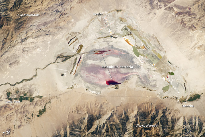
Image of the Day: Owens Valley
Posted on | September 12, 2011 | No Comments

Hat tip to the Great Basin Water Network for forwarding this link to today’s image from NASA Earth Observatory of Owens Valley (formerly lake) in the Eastern Sierra. “The present-day Owens Lake was once part of a much larger lake and river system along the northeastern border of California and Nevada during the Pleistocene Epoch (about 3 million to 12,000 years ago),” reads the NASA caption. “Melt water from alpine glaciers in the Sierra Nevada filled the regional valleys of the Basin and Range to form glacial lakes—ancestors of the now-dry lakebeds (or playas) of Owens, Searles Lake, and China Lake. While Searles and China Lakes dried out because of regional changes to a hotter and drier climate, Owens Lake became desiccated largely due to the diversion of the Owens River in the early 20th century to serve the needs of Los Angeles, 266 kilometers (165 miles) to the south.” Click here to keep reading about one of LA’s primary water sources at the Earth Observatory website.
The Great Basin Water Network is publicizing the image because it worries that proposed groundwater pumping in eastern, central Nevada by Las Vegas water prospectors might create the same kind of desiccation. While Vegas water managers steadfastly argue that Owens Lake was “surface water” and their Nevada project involves pumping groundwater, it merits pointing out that after LA drank Owens Lake, it began pumping the groundwater (for a 2010 look at pumping budgets and impacts, click here). Mitigating the air pollution that resulted from windborne dust now costs LA hundreds of millions of dollars and is a vexed, unfinished endeavor.
Tags: chance of rain > Emily Green > NASA Earth Observatory > Owens Valley
Comments
Leave a Reply


