No news is no news for El Niño prospects
NOAA's State of the Climate report for October shows drought across 60.2% of the contiguous United States. Elsewhere, Pacific Ocean monitoring indicates that a weak El Nino system associated with wetter winters in Southern California and the Southwest has petered out into neutral conditions.Warmest January to September on record
NOAA's October State of the Climate update shows January through September 2012 the warmest first nine months of any year on record.Third hottest summer since 1895
Summer 2012 significant temperature recordings and events from NOAA's "State of the Climate" page“Hottest month on record for the nation”
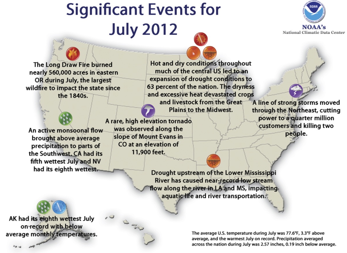
July 2012 was “3.3°F above the 20th century average, marking the hottest July and the hottest month on record for the nation,” reports the National Oceanic and Atmospheric Administration. Click here for the report or on the image to enlarge it.…
Hot earth day
"Most of the US experienced record or near-record breaking temperatures, contributing to the warmest March since national records began in 1895," reports the National Oceanic and Atmospheric Administration. Click on the map for NOAA's March 2012 global climate analysis. After reading it, if you live in Southern California, Nevada, Arizona etc, what are you waiting for? Rip out your lawn. It will save roughly half of the water you use, the often dirty energy needed to pump that water hundreds of miles from wet places to dry ones, the energy needed to mow the lawn once a week, the air pollution caused by the mowers, and the energy needed to cart away and process the green waste. For support on landscape alternatives, check your local native plant society.
North American Native Plant Societies

After the lawn

Garden blogs
