Make yourself at home
Posted on | February 23, 2023 | No Comments
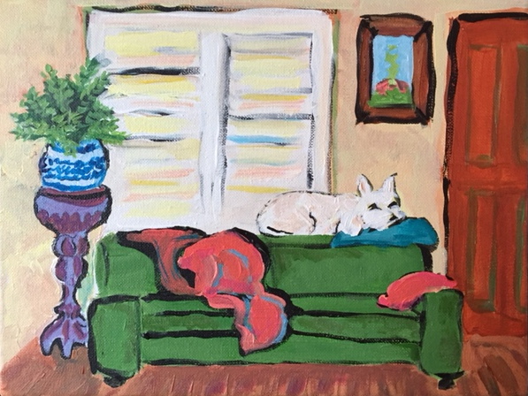
Angus waiting for Donna, acrylic on canvas, 2016, Emily Green
This site is intended mainly as an online clipping service for the reporter Emily Green. Click here to be taken to the journalism archives. Occasional posts below vary between brain-on-fire moments and links to work published elsewhere. Sidebar links to various environmental sites are random acts of enthusiasm.
My friend Wally
Posted on | February 22, 2024 | 3 Comments

I’d been gone from West Adams for twelve years, and California for eight, when last December an old friend, Karen Haas, reached out from Los Angeles to say that our neighbor and dearest of friends, Walter Matsuura, had died at at home. In an unrepayable act of kindness, Karen then suggested and artfully edited this remembrance, which she read at Wally’s memorial service last week.
If you’d said to me in London that when I moved to Los Angeles, the person closest to me would be a retired Republican cop, I would have declared it impossible. But when I moved next door to Wally in 1998, he became family.
Our ritual of meeting for Sunday evening martinis began early on. We would sit in my kitchen tipsily plotting to get Wally’s lodger Bobby to stop drinking, which for a Halcyon era that followed, Bobby did. That Sunday ritual, Wally’s and mine, lasted maybe six years, long enough that when I was garden-writing for the Times, and the Hancock Park Garden club came a-snooping, the most remarked-upon feature was the dead tree strung with our empty Bombay Sapphire Blue gin bottles. At some point, one I’ve since learned comes to all of us, Wally gave up drinking spirits, and we retired our martini glasses.
Read moreTo Maryland, with love
Posted on | October 2, 2023 | No Comments
So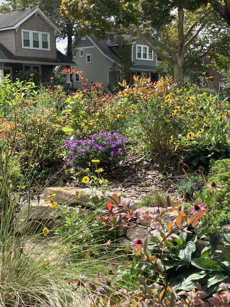 me sites are easy to landscape, others aren’t. The job featured here wasn’t. Judge for yourself whether it was worth it by perusing this photo-essay of the conversion of a conventional garden to a wreath of Maryland’s native rudbeckias, lobelias, viburnums, junipers and asters. Those curious about plant identifications are encouraged to scroll beneath the pictures to the captions. For an all-out guide to gardening in the mid Atlantic, this resource directory, produced last spring for the Baltimore Banner, comes into its own again as fall affords an even more temperate window to establish new plantings.
Bannon
Posted on | January 20, 2023 | 4 Comments
 After 27 years of pot smoke seeping through the tenth floor hallway of the Wilshire Royale, the stoner in 1012 is dead. As new owners incrementally zhuzhed up the Beaux Arts building at Wilshire and Rampart, formerly a Howard Johnson’s, and a number of hotel and assisted living iterations before that, my friend David Bannon joked that he would only leave his corner unit feet first. That he did on January 11th, aged 77, after electing medically-assisted suicide in lieu of cancer treatment. Surviving relations, for whatever reasons, have so far left his obituary to a two-line death notice issued by the cremation company. This may have been Bannon’s instruction. His erasure only underscores the sense of loss. Eccentricity is dead. Movies have had their day. Reading is over. David Gerard Bannon will no longer live to watch movies and read books and talk about them with his fractured network of cineastes and people who read. Read more
Behold the holly
Posted on | December 16, 2022 | No Comments

North American Native Plant Societies

After the lawn

Garden blogs
