La Niña watch begins
Posted on | June 3, 2010 | 4 Comments
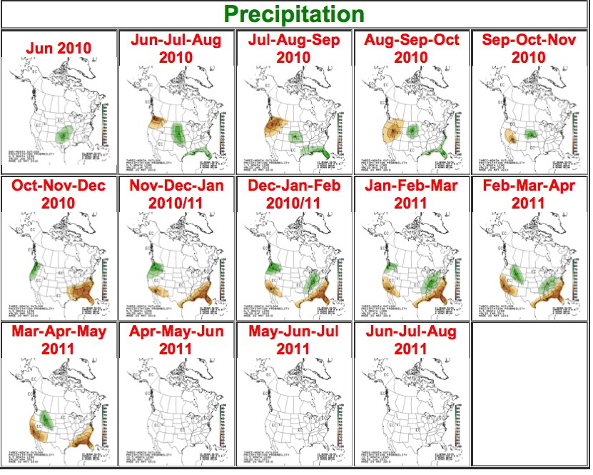
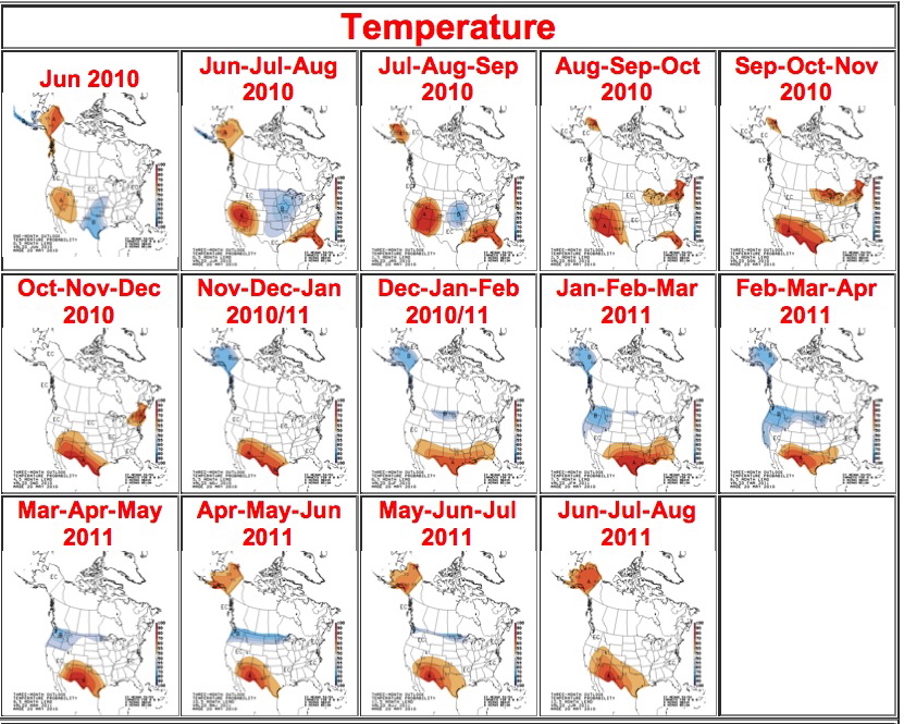
 After 16.36* inches of rain recorded for downtown Los Angeles from June 2009-June 2010, ocean conditions indicate a transition from the mildly wet El Niño system that gave Southern California a slightly better than average rainfall year to a dry La Niña one, according to the National Weather Service. An experimental and unofficial outlook map set issued by its Climate Prediction Center lays out a hot and dry 2010/11. Jet Propulsion Laboratory oceanographer Bill Patzert is already betting on a dry La Niña 2010/11 season. “Two years of El Niño are just such a low probability,” he said. “Six out of ten years are dry. I wish I had those odds in Vegas.” For those who think in terms of “normal” rainfall for Los Angeles, he added, “Normal is a cycle on a washing machine.”
*From the NWS California Nevada Forecast Center. NWS Los Angeles / Oxnard records show the total for the same period to be 16.51 inches.

Tags: Chance or Rain > Emily Green > La Nina > National Weather Service
Comments
4 Responses to “La Niña watch begins”
Leave a Reply


June 3rd, 2010 @ 9:30 pm
How does La nina affect air temperature. Cooler than normal summer? Or just cooler winter?
June 4th, 2010 @ 7:57 am
Here’s a link to NOAA’s weekly El Nino/La Nina report: http://www.cpc.noaa.gov/products/analysis_monitoring/lanina/enso_evolution-status-fcsts-web.pdf
June 4th, 2010 @ 8:18 am
Thanks Kevin for the link. Hi Bob. Here is a link to La Nina temperature probability maps from NOAA: http://www.cpc.noaa.gov/products/analysis_monitoring/lanina/usdivtp/writeup.shtml#usmaps and here is a link to NOAA’s La Nina information page:
http://www.elnino.noaa.gov/lanina_new_faq.html
August 15th, 2010 @ 7:23 pm
I think the short answer is yes. La Nina has created cooler than normal late summer conditions for 2010 – in California. And dryer conditions are expected for early 2011 and summer 2011.