High good, low bad: Mead in November
High good, low bad: Mead in October
Source: University of Nevada, Las Vegas, Digital Collections.
WHEN the Colorado River’s water was divided by treaty in the 1920s, Nevadan negotiators never imagined that Las Vegas would need more than 300,000 acre feet of water a year (compared to Arizona’s 2.8m and California’s 4.4m). The population of Clark County was roughly 2,500. Its largest city, Las Vegas, a railroad town, already had groundwater and native springs, if not the semitropical climate promised in this Chamber of Commerce brochure, date unknown.
The once ebullient springs of Las Vegas are now dry, Clark County is 90% dependent on that 300,000 acre feet of water from Lake Mead, the reservoir containing Colorado River water impounded behind Hoover Dam. The population of greater Las Vegas is roughly two million and cities such as San Diego, Phoenix and Los Angeles also vie for water from water in Lake Mead.
Meanwhile, Mead is shrinking. …
High good, low bad: Mead in September
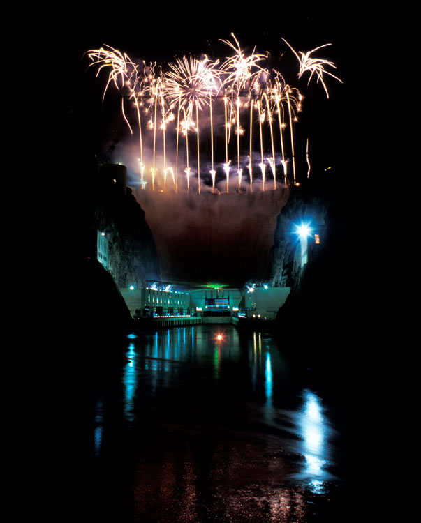
Fireworks over Hoover Dam in 2002 for the US Bureau of Reclamation centennial. Photo: USBR. The year of Reclamation's centennial was at the time the worst on record for snowmelt recharging the Colorado River. Fast shrinking reserves in Lake Mead behind Hoover Dam convinced quarreling states along the Colorado River that the days of surpluses were over and the Colorado River was headed into an epochal drought.
COMPLETION of Hoover Dam in 1936 created Lake Mead, the largest reservoir in the United States. It holds Colorado River water serving California, Arizona, Nevada and the Republic of Mexico. Climate change and population growth in Las Vegas, Phoenix, San Diego and Los Angeles have reduced the lake’s elevation more than 32 feet in the last five years. Here are year-on-year US Bureau of Reclamation closing elevations for September going back to 2004:
DATE ELEVATION
September 30, 2009…
High good, low bad: Mead in August
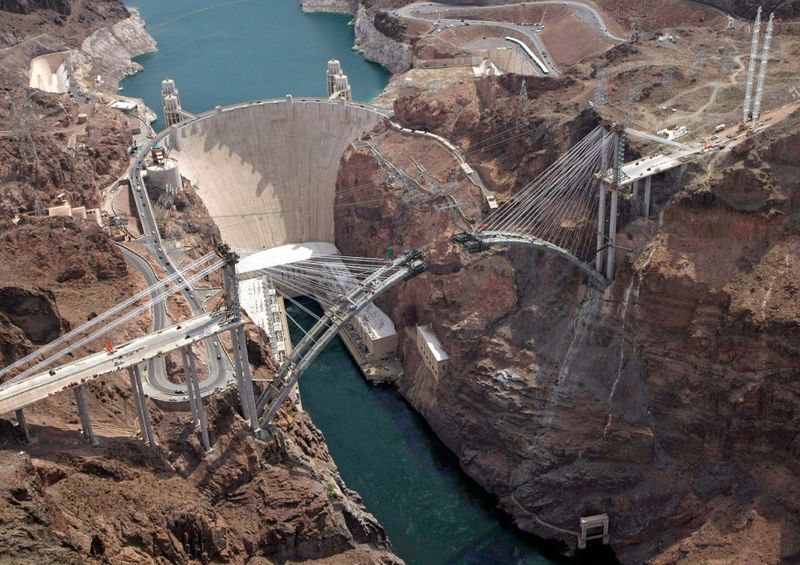
THE HOOVER DAM BYPASS bridge joining Nevada and Arizona neared completion over the Colorado River last month. Scheduled to open in 2010, it was recently dedicated as the Mike O’Callaghan-Pat Tillman Memorial Bridge in honor of the former Nevadan Governor and Arizona serviceman. Only the dead know what Mike O’Callaghan, who died in 2004, would make of the honor. The bridge enables yet more Las Vegas sprawl while the former governor and editor of the Las Vegas Sun was a fearless critic of the water policies of Southern Nevadan developers, including those backed by his protege, US Senator Harry Reid.…
High good, low bad: Mead in July
Lake Mead is the Colorado River Reservoir holding water supplies for California, Arizona, Nevada and the Republic of Mexico. The Landsat photos (left) compare water levels between 1990-2009. The red rim in the lower right image marks the receding water line.
The maximum elevation is 1,229 feet. The closing elevation for July 2009 was 1,094.20. The lake has dropped 31.53 feet in the last five years.…
« go back — keep looking »North American Native Plant Societies

After the lawn

Garden blogs
