Salton Sea et al
For those who have asked about the impact of of this week’s ruling by Sacramento Superior Court Judge Roland Candee as it affects the Salton Sea restoration deal incorporated in the 2003 Quantification Settlement Agreement and Joint Powers Authority funding agreement (QSA JPA), here are some relevant excerpts from the decision. Copious numbered references have been struck for coherence and eyeball-busting acronyms have been decoded. The full text of the decision is available here.
These edited excerpts come from Sections 6 through 9, pages 33 through 43 of the decision.
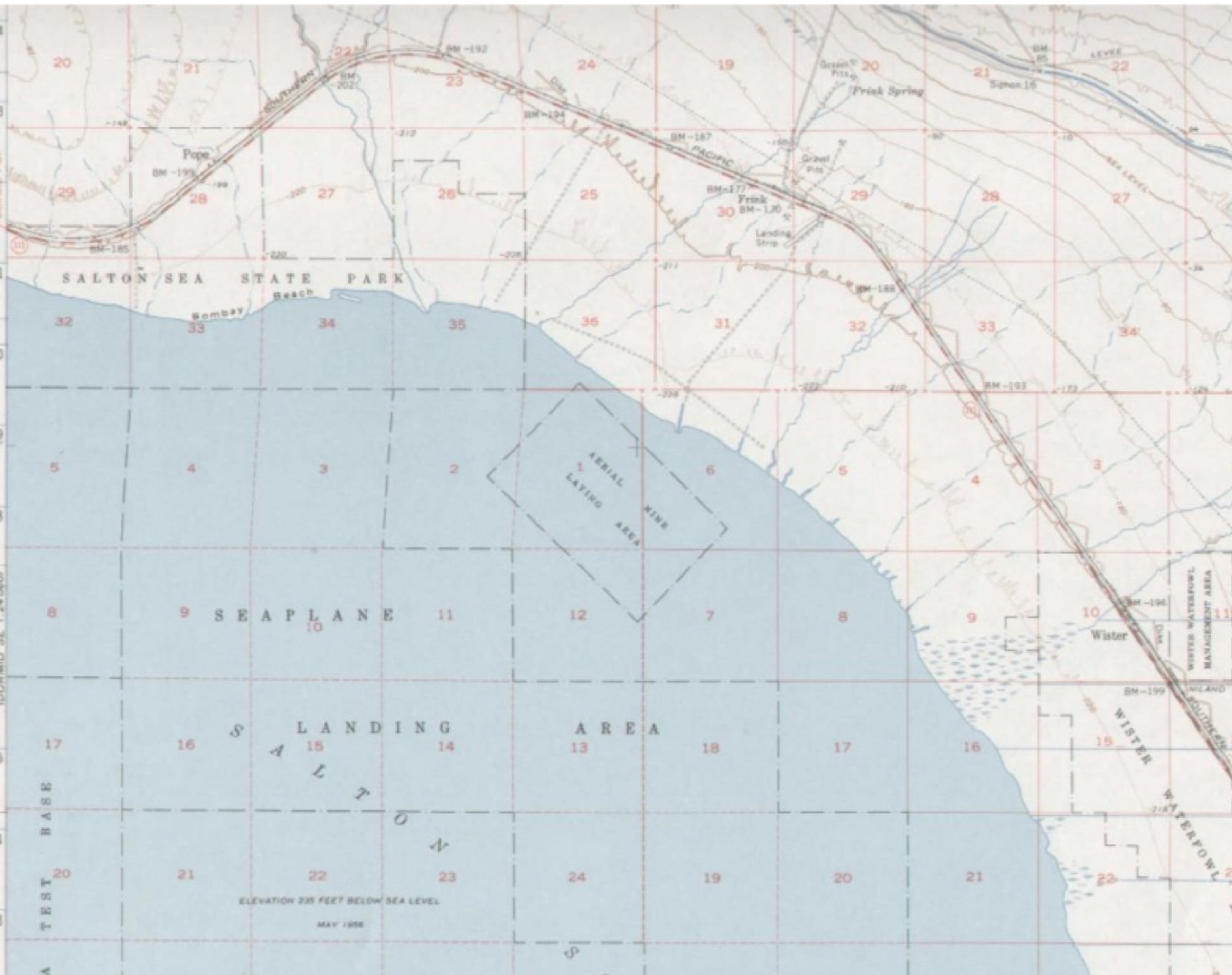
“Dealing with the Salton Sea appears to the Court to have been the single most significant environmental issue faced in the QSA process. The Salton Sea is California’s largest lake, located north of the Mexican border at the northern end of the Imperial Irrigation District service area and the southern end of Coachella Valley Water District’s service area.
“It …
Fasten your seat belt, California
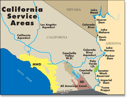
The reported voiding of the Quantification Settlement Agreement today by Sacramento Superior Court Judge Roland Candee has put a concentrated bounce into what Southern Californian water managers have long fashioned as their “hard landing” after they were forced in 2003 by six less well-off states sharing the Colorado River to stop hogging as much as 962,000 acre feet of water above their legal allotment of 4.4 million.
In spite of unfettered urban development across the Colorado River service area in the lead-up to the 2003 cap, Southern California cities managed to reduce their reliance on the river in part by legalizing trades of water from the wildly well endowed agricultural rights holders of the Imperial Irrigation District and neighbors, who had between them 3.850 million acre feet of water. However, evidently not everyone in the Mojave farming community approved of the QSA. Imperial, in a bid to reaffirm its …
High good, low bad, Mead elevations 1999-2009
Source: federal Bureau of Reclamation. Click on the image for its 2010 operating plan for the Colorado River.
NOT everything went down during the Noughties. While federal Bureau of Reclamation records show that the elevation of Lake Mead, the major “lower basin” Colorado River reservoir serving Arizona, California and Nevada, fell more than 117 feet, the population of the US states served by Mead rose. The US Census Bureau estimates that the population of the driest state in the country, Nevada, climbed 32.3%, while Arizona’s increased 28.6% and California’s 9.1%.
If Lake Mead were a financial institution, people might, stress on might, question the logic of outgrowing one’s resources. As John Fleck of the Albuquerque Journal pointed out after reading the first version of this post, Mead is at its lowest elevation since it was first filled in the 1930s.
But the spendthrift lower basin states such as Nevada have …
“Glen Canyon is talking back”
“I don’t know that there’s very many people in the world who want to kiss, love, hug, lick, touch, and talk to sandstone,” says 89-year-old Katie Lee, as she sums up the loss she felt when the 170-mile Glen Canyon in Arizona was dammed in 1965. The Colorado River backed up, creating one of the largest reservoirs in the United States, Lake Powell, etching about 2,000 miles of shoreline as it flooded the main canyon and nearly 200 side canyons.
… To read more from a purely magical story in the environment pages of the Christian Science Monitor, click here.
Via the Great Basin Water Network and Aquafornia.…
High good, low bad: Mead in July
Lake Mead is the Colorado River Reservoir holding water supplies for California, Arizona, Nevada and the Republic of Mexico. The Landsat photos (left) compare water levels between 1990-2009. The red rim in the lower right image marks the receding water line.
The maximum elevation is 1,229 feet. The closing elevation for July 2009 was 1,094.20. The lake has dropped 31.53 feet in the last five years.…
« go back — keep looking »North American Native Plant Societies

After the lawn

Garden blogs
